More Beautiful Maps: Announcing DynamicMapsEngineLayer
June 26th, 2013 | Published in Uncategorized
Organizations around the world use Google Maps Engine to host their geospatial data: ecological records used in the fight against habitat destruction, census income and age distributions, and up-to-date store locations and hours. Much of this data is available for public consumption.
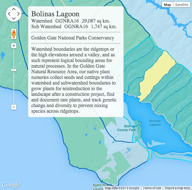
Today we’re announcing a new way for developers to visualize and interact with data hosted in Maps Engine: DynamicMapsEngineLayer. This class performs client-side rendering of vector data, allowing the developer to dynamically restyle the vector layer in response to user interactions like hover and click.
Play around with this map of public watershed boundary data from the Golden Gate National Parks Conservancy, one of our Maps Engine nonprofit grantees:
 To get started making your own maps, check out our developer documentation for DynamicMapsEngineLayer and find public datasets hosted by Maps Engine that interest you in our gallery (if there is a “Maps API code” link below a map, click it and copy the code snippets shown). For a deeper dive, also take a look at the Google Maps Engine API, a RESTful web services API that allows developers to read and write data stored in Google Maps Engine, and learn about querying public datasets. Contact us for more information about Google Maps Engine for your organization.
Posted by Jen Kovnats, Product Manager, Google Maps API
Today we’re announcing a new way for developers to visualize and interact with data hosted in Maps Engine: DynamicMapsEngineLayer. This class performs client-side rendering of vector data, allowing the developer to dynamically restyle the vector layer in response to user interactions like hover and click.
Play around with this map of public watershed boundary data from the Golden Gate National Parks Conservancy, one of our Maps Engine nonprofit grantees:

Posted by Jen Kovnats, Product Manager, Google Maps API