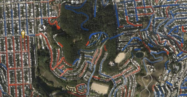
Map of the Week: Hill Mapper San Francisco
July 31st, 2013 | Published in Uncategorized
Map of the Week: Hill Mapper San Francisco
Hill Mapper San Francisco uses the Elevation API to show how steep streets are in San Francisco.
Streets that go uphill, relative to the current location of the marker, are red, and downhill streets are blue. The opacity of the color represents how steep the hill is.
If you drag around the marker, the Polylines change color, as the marker’s elevation changes the relative elevation of the streets.
It’s particularly powerful if you view it with satellite imagery.
If you want to search for a particular location, the search box uses Places Autocomplete to help you find it.
All around, this is a nice, innovative use of our APIs to show off useful information.
Posted by Mano Marks, Maps Developer Relations Team