Spreadsheet Mapper 3: More placemarks, advanced customization, and more
May 11th, 2012 | Published in Google Earth, Google Maps
Do you have a spreadsheet of locations that you’d like to see on a map? Here on the Google Earth Outreach team we talk to many nonprofits who use Google Earth and Maps to tell their stories and visualize their data. Often the data is in spreadsheets, or other tabular formats. Converting these rows and columns into a map brings the spreadsheet to life by providing geographic context and a new way to visualize the information.
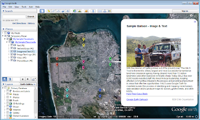
Spreadsheet Mapper is a tool that enables anyone to easily create a well-designed KML file to show off their data in Google Earth and Maps. Since Spreadsheet Mapper is a Google Docs template, you fill in your data using the familiar interface of a spreadsheet, and create a great KML without any coding. It gives you all the cloud-based benefits of Google Docs, including collaborative editing and the ability to publish directly to the web.
When we released Spreadsheet Mapper 2 a few years ago, it had a number of limitations, especially with regard to the number of placemarks it could create and the available balloon templates. In response to user feedback, and taking advantage of new features in Google spreadsheets and Google Apps Scripts, we have upgraded Spreadsheet Mapper with a variety of new and improved features:
- More placemarks: Support for 1,000 placemarks and ability to add more as needed
- Flexible balloon design: Take advantage of even more balloon design templates and simplified starter templates
- Simplified publication: Just click “Publish to the web” to share your map (no more fussing with URLs)
- New customization options: Advanced users can change the default view and network link details

We hope these new tools make mapping from spreadsheet data easier than ever!