Map of the Week: DTS Campus Map
March 7th, 2013 | Published in Google Maps
Map of the Week: Dallas Theological Seminary Campus Map
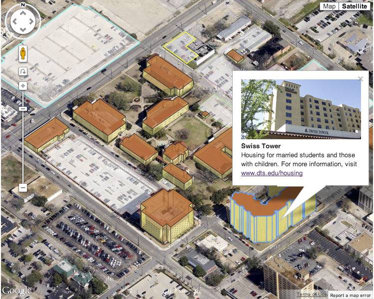
Why we like it: The DTS campus map takes advantage of the Google Maps API 45° imagery to display the campus in a unique way. The map creates extruded shapes for the buildings, making a polygon for each wall of the building and of the roof. And by using polygons, it was easy for the developer to add in infowindows as well.

Even more impressive, when you rotate the image, the map redraws the buildings so they stay in the correct orientation.
This map is an excellent example of simply making the Google Maps experience even better.
Posted by Mano Marks, Maps Developer Relations team
Why we like it: The DTS campus map takes advantage of the Google Maps API 45° imagery to display the campus in a unique way. The map creates extruded shapes for the buildings, making a polygon for each wall of the building and of the roof. And by using polygons, it was easy for the developer to add in infowindows as well.
Even more impressive, when you rotate the image, the map redraws the buildings so they stay in the correct orientation.
This map is an excellent example of simply making the Google Maps experience even better.
Posted by Mano Marks, Maps Developer Relations team