Vancouver in 3D
January 28th, 2009 | Published in Google Earth
Growing up in Vancouver during its mushrooming period, which began in the mid-'80s, I witnessed a small city's downtown core give way to a cosmopolitan urban center (or "centre," as we write) of glass towers. Approaching the peninsular downtown, encased by rugged mountains and the Pacific, any local still feels awe at its newfound density and how much it's grown.
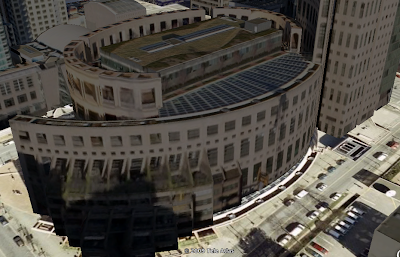
Yesterday, more than 1400 buildings in Vancouver became visible in Google Earth's "3D Buildings" layer. With the 2010 Winter Olympics just a year away, I'm especially excited that you can now get a richer sense of Vancouver's distinctive splendor, which marries advanced urban development with a dramatic coastal landscape. You can see places like Moishe Safdie's colosseum-like Library Square, the waterfront Canada Place (with its "Five Sails"), and Olympic venues such as the domed B.C. Place stadium.
I think you'll see why this city is routinely voted one of the world's most livable:


To those seeing Vancouver for the first time, I hope you'll realize it's a city worth visiting (I'd suggest in the summer, when it rains less). To the other Vancouverites, I hope this rich, rain-free view of your home makes you appreciate it even more.