NYC subway system on Google Maps
November 6th, 2009 | Published in Google Earth
My wife and I moved out to New York last week, and we sure put Google Maps to use in our housing hunt. With Real Estate listings to help find a place, Street View to scope out the neighborhood, directions to help us find our broker, and local search to find nearby amenities, just about the only thing that we needed another source for was to see where the extensive subway lines ran. Until now!
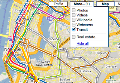
We're happy to announce that you can now see New York's subway lines drawn out directly on Google Maps as part of the transit layer. To turn it on, just point Google Maps to somewhere in New York, click on the "More..." button at top-right, and select "Transit":

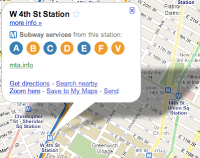
The colorful lines aren't just pretty to look at, they're also interactive. When you click on any station name, a bubble pops up with the names of the line that service the station, and all the other lines on the screen fade out.

This new feature compliments the New York transit directions we launched last September, for all services offered by the MTA, including bus, ferry, commuter rail, and of course the subway. We cover much more than the Big Apple, so look for the transit layer in other cities like Paris and Tokyo, and use transit directions with over 436 agencies around the world.
Having the MTA in the transit layer will certainly help me get my way around my new hometown, as I start to familiarize myself with the nation's largest public transit system. I can even pull up the layer on my mobile phone while on-the-go (read more on the Google Mobile Blog). We're happy to say that we found a great place in Brooklyn — and based on the leafy green trees and walk-up brownstones in Street View, some friends back in California are convinced we're moving to Sesame Street!