A taste of what’s to come
March 18th, 2009 | Published in Google Earth
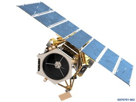
 On September 6th 2008, satellite imagery company GeoEye successfully launched the world's most advanced commercial imaging satellite, GeoEye-1, into orbit. After nearly 4 months of in-orbit checkouts they officially announced the start of GeoEye-1 commercial operations in February. Since then they have been building their archive with beautiful images of our planet, such as this one of the pyramids near Cairo, Egypt:
 In the coming months you will start seeing stunning GeoEye-1 imagery blended into our database and viewable through Google Earth, Maps, and Google Maps for Mobile, but until then you can visit http://earth.google.com/geoeye/ to download a KML preview of full resolution GeoEye-1 imagery to get a taste of what's to come. As exciting as these images are, remember: there will be even more coming soon!